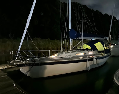
Ramsgate has many charms, but the swell that can roll right around the corner into the marina is not one of them. Soon after 0400 I gave up attempts to sleep, checked the forecasts for the umpteenth time, and started getting ready to go. I put a reef in the mainsail, just in case the winds were as strong as the most pessimistic forecast said they might be. It took me a while to set up the lines as I really wasn't sure how to wiggle out in the dark on my own, with light westerlies pushing me on to the finger pontoon. In the event I just reversed out with no problem at all, then realised I had done everything except switch on the navigation lights. Kalessin held her position quietly for a few moments while I dashed below to put them on, then motored out of the harbour at 0505. There was no sound at all on the port control VHF channel so I assumed (correctly) that nothing was moving.
 |
| Anchored tanker at dawn |
Out at sea there was less swell, less wind, and lots of tide pushing me past North Foreland. The one pilot book I hadn't brought with me was Crossing the Thames Estuary, but I hoped I'd have either cross-tide or fair tide for most of the way, which in fact was correct. The many lights ahead turned out to be the anchored ships off Margate, and once I got beyond them into the main Thames channel it was a bit choppier. Once it got light enough to see what I was doing, I put up the mainsail, which didn't do much in light W to NW winds but at least didn't flap.
These are moderately familiar waters, although with wind farms constantly under construction they are slightly different every time. In calm conditions I always take Foulger's Gat and cut across the Sunk Sand, which makes for an almost straight route. I later found that with a modest payment to Marine Traffic I could see my track (above). I wish I'd done it earlier, as you can only see three days' worth. The red dot just north of Margate is me going slowly to put up the sail, and the wiggle further north is going up the East Swin and around the head of the Gunfleet Sand, as by this time it was close to low water.
 |
| Crossing the London Array at Foulger's Gat. It was calmer in the shelter of the sandbanks and I topped up with 10 litres of diesel - not really needed, but it made me feel better |
When we sailed home with the boys we knew we weren't far off when someone shouted "I can see the cranes!" The Felixstowe cranes are so big you can see them from at least 15 miles away. I was actually very lucky as there was rain all around me, but I sailed in my own fairly dry circle. Eventually at around 0930 the rain lifted and I could see the cranes, and I must admit I was in tears. Golly.
 |
| Landguard buoy and the cranes of Felixstowe |
As I passed Landguard my phone buzzed. Richard and Cathy Brown had been tracking me on AIS and could see I wasn't far off. If I could tell them which berth I was heading for they would come and take my lines. I phoned SYH who allocated me F162. With lines and fenders all rigged I finally turned in to Suffolk Yacht Harbour and headed in. I could see Richard and Cathy but no space... the berth was occupied! I called on VHF and they allocated a different berth on M. I headed very slowly down the marina to give Richard and Cathy time to get there. Oh no! That one was occupied too! Thanks SYH!! Fortunately I could squeeze into a little space in the corner. The long journey was over and it was time to celebrate. Yes, that's bubbly in the photo at the top. I didn't have champagne flutes on board but at least they were glass.
Distance run: 45 miles.
Donations are still very welcome at https://www.justgiving.com/page/camilla-herrmann-roundbritain
 |
| Snug in a sheltered corner, Kalessin is home |


No comments:
Post a Comment